A short article written for the Friends of the Kintyre Way: Friends of The Kintyre Way | Walking on walking the Kintyre Way, a 100-mile waymarked trail in western Scotland.
Walking the Kintyre Way is a work of art. This is what I scribbled in my journal while on the beach at Tayinloan, around midway through my walk.
The trail is a blank canvas: open to interpretation, the walker both the artist and viewer. The walk itself is the creation; the when, the hows, the whys. After this, after all the planning and effort and walking, what is left, the work of art, is in the memory.
I walked the length of the Kintyre Way in July 2023. Boarding the bus for Campbeltown, the tenements and busy city streets of Glasgow soon gave way to the outskirts then, surprisingly quickly, we were coasting along Loch Fyne. A threshold was crossed at Inveraray. The driver turned off the engine, got off the bus and sat on a wall licking an ice-cream. Passengers alighted, gradually gathering around the driver. Soon we were relaxing in each other’s company. We were away from the anonymous, constricted city and moving into a freer, more open landscape.
Everything continued to open; the views, the air, the loch began to beckon sea. It was late afternoon when I alighted at the skull of the Mull: in Tarbert, the start (or end) of the Kintyre Way. I stocked up on supplies from the Co-Op, carrying three days’ worth. It being summer my plan was to wild camp wherever I found myself at the end of each day. This needed some planning but not overthinking; to be an adventure there must be room for uncertainty.
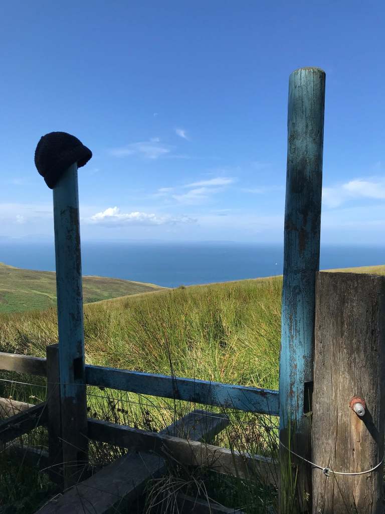
It is a joy to find your way. I skirted along Tarbert’s bustling harbour looking for the first signs. I found what would be my companions for the next week; the pale blue marker posts pointing up and away from Tarbert and onto the Kintyre Way.
Falling into the rhythm of a trail is like getting to know a new friend. There is wariness; senses are heightened until trust is gained. How distinct is the path? How visible are the marker posts? How frequent?
That evening I sauntered along the trail, slowly attuning to its rhythm, heading up into the hinterland and descending towards a backlit view of the Arran mountains. The famed Seafood Cabin at Skipness was closed so I settled for my egg sandwich and a bannock for tea, pitching my tent with a fine view across the Kilbrannan Sound.
The next morning ferry traffic from Claonaig to Lochranza on the Isle of Arran was languid. But I felt full of energy, glad not to be encased in a van or car. The trail pointed me away from the coast, back up towards the spine of the Mull, crossing a moor, an empty landscape; the likes of which it is only possible to experience on foot.
I found one of the joys of the Kintyre Way to be this criss-crossing of the roadless interior.
After lingering at the excellent Clachan petrol station – a lifeline of pies, hot drinks and snacks – I followed the route down the west coast.
I knew this road well from driving. In years past I’d raced down it towards the open beach of Westport to go surfing. Up near Clachan, the isles of Jura and Islay prevent the Atlantic swells arriving at the coast. The beaches around Clachan, therefore, had held no interest for me. Passing through there had been anticipation, speed.
But on foot there can be no such hurry. As cars and lorries and the Glasgow coach zoomed past, I enjoyed moving at my own rhythm, mixing my terrain between the path and the soft, white sand of the beach.
That evening I found a niche in a sand dune near Tayinloan for my tent pitch, enjoying my Clachan pie, an éclair and a beer watching the sun dip behind the Paps of Jura. Coastal camps are a passion of my mine and being able to camp on east and west facing coasts on consecutive nights offered alternate light on my journey.
A walk like this is a work of art, I wrote while sipping my coffee the next morning.
I was back on the trail early, drawing my own lines back over the middle of the Mull once again, into thick cloud and passing the 50-mile half-way point. The more mountainous, remote terrain was unexpected – perhaps it was not remote, but being on foot made it feel so.
A storm hit as I descended into Carradale. The wind and horizontal rain made a coastal camp dicey so after enjoying a pint and packet of crisps in the pub I found a large oak tree and pitched beneath it.
Walking all day makes sleep particularly delicious. Despite my being sodden to the core and a legitimate storm raging outside, I slept like a saint for a good nine hours. Stretching my stiff limbs out of the tent in the morning, the storm had passed leaving a humid calm. I stumbled back onto the trail, along the slippery rocks on the coast then, after enjoying a heavenly coffee at the Torrisdale Café, striking up into the hills.
This was to be a long day: 22 miles from Carradale to Campbeltown, the main town on the Mull of Kintyre. Just past Ifferdale Farm I found a waterfall, perfect for a quick shower. It is marked by a cairn but easy to spot as it is next to the track.
When I arrived close to the shores of Lussa Loch I decided to take a break. As I went to sit down, a large adder slowly uncoiled itself and slithered into the bracken. She was by far the largest snake – perhaps one metre long – I’d ever seen in Scotland and changed the way I’ve looked at the landscape ever since.
I trudged along roads into the metropolis of Campbeltown. Here there are lots of accommodation options. I stayed at my Mum’s house, but if wild-camping I’d probably pitch somewhere around Lussa Loch, being mindful of who my neighbours were.
I was on a schedule so I continued on; if doing the walk again I’d certainly build in a couple of rest days, and Campbeltown would be a natural resting point.
But it was onward in blowy sunshine. I found this section of road walking tough, but there were great views out to sea, especially passing Davaar and getting a sense of rounding the Mull: the route follows the coast from east-facing Campbeltown round to the southern-facing Southend.
Beyond the Keil caves, I enjoyed my final tent pitch of the walk in the dunes at Carskey Bay, looking south to Sanda Island and wondering what my final day would bring.
It brought very low cloud, and I was anxious following the Way up from Amod Farm into almost white-out conditions. I knew from the guide this was the most remote section of the Way. But I was committed so I set forth, keeping at least one of my friends – the pale blue marker posts – in view. As these things often do, by mid-morning the mist burned off, leaving a bluebird sky and sunshine for the whole day.
This final section was my favourite, getting a true sense of the bulk of the Mull, and heading along the glorious coastline back up towards Machrihanish, looking across to the coast of Northern Ireland which I had no idea was so close.
Arriving in Machrihanish, after 6 days of constant walking, was heaven. I ceremoniously retired my well-worn walking boots by placing them in the bin. I took a refreshing dip in the sea and then donned my flip flops.
The final flourish on my journey was a short ride to the airport. I boarded the Loganair flight to Glasgow, along with two other passengers. Soon we were high above the Kintyre Way: there were the coasts, there was Lussa Loch, there the track over the spine, all laid out like a perfectly arranged diorama.
The work was complete. Within half an hour we were landing, back in the throes of Glasgow, the effort of the walk felt in my whole body, its story already percolating into my memory.


Leave a Reply